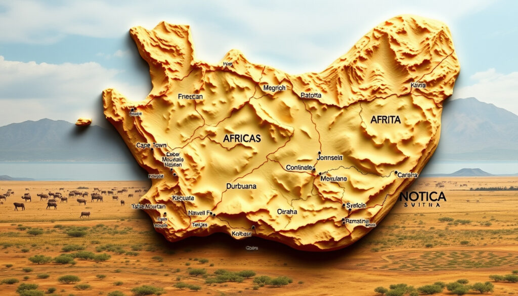
Map of South Africa: Provinces, Cities, and Tourist Guide
Anyone who has glanced at a map of South Africa notices two things right away: the country’s compact shape and the surprising number of provinces packed inside. That nine-province layout — born out of the post-apartheid system — is the key to navigating everything from Cape Town’s coastline to Johannesburg’s urban core.
Total land area: 1,221,037 km² · Number of provinces: 9 · Capital city: Pretoria (administrative), Cape Town (legislative), Bloemfontein (judicial) · Largest city: Johannesburg · Total population (2023 est.): 60.6 million
Quick snapshot
- 9 provinces with unique geography (South African Government official tourism portal)
- Cape Town (Western Cape), Johannesburg (Gauteng) (South African Government official tourism portal)
- Each province has a capital city (Government Communication and Information System provincial data)
- Johannesburg: largest city (Britannica city listings)
- Cape Town: legislative capital (Britannica city listings)
- Durban: major port city (South African Tourism destination marketing)
- Namibia, Botswana, Zimbabwe to north (Nations Online Project world atlas)
- Mozambique and Eswatini to east (Nations Online Project world atlas)
- Lesotho: enclave within South Africa (Wikipedia provincial geography)
- Kruger National Park (SA-Venues travel maps)
- Garden Route (SA-Venues travel maps)
- Table Mountain, Cape Town (SA-Venues travel maps)
Because South Africa’s tourism content is organized by province, any traveler’s first step should be identifying which province their destinations fall into — a map is not just a reference, it’s a routing tool.
Eight key facts about South Africa, one pattern: the country’s geography is defined by its nine provinces, three capitals, and a single enclave nation.
| Label | Value |
|---|---|
| Official name | Republic of South Africa |
| Capital cities | Pretoria (administrative), Cape Town (legislative), Bloemfontein (judicial) |
| Largest city | Johannesburg |
| Land area | 1,221,037 km² |
| Population (2023 est.) | 60.6 million |
| Number of provinces | 9 |
| Bordering countries | Namibia, Botswana, Zimbabwe, Mozambique, Eswatini, Lesotho |
| Coastline length | 2,798 km |
How Many Provinces Are on a South Africa Map?
South Africa is divided into nine provinces, a structure that took effect after the end of apartheid and is now the standard organizing unit for travel maps and government planning. The South African Government official tourism portal groups travel information by province, reinforcing that the map you see is built around these nine regions.
List of the nine provinces with capitals
- Western Cape — Cape Town
- Eastern Cape — Bhisho
- Northern Cape — Kimberley
- Free State — Bloemfontein
- KwaZulu-Natal — Pietermaritzburg
- North West — Mahikeng
- Gauteng — Johannesburg
- Mpumalanga — Mbombela
- Limpopo — Polokwane
The list is drawn from the SouthAfrica-Info province database, a tier-3 source that aligns with official government data.
Provincial boundaries and sizes
Provinces vary enormously in area. Gauteng is the smallest and most urbanised — described by the Government Communication and Information System provincial comparison as “tiny and crowded” — while the Northern Cape covers nearly a third of the country’s land. The implication: a tourist map must show province boundaries because driving distances between, say, Upington and Cape Town are vastly different from a trip across Gauteng.
Where Are Cape Town and Johannesburg on a Map of South Africa?
Cape Town sits on the southwestern coast of the Western Cape province, while Johannesburg lies in the northeastern interior of Gauteng. The straight-line distance between the two is roughly 1,400 km — a fact that surprises many first-time visitors who expect a shorter hop.
Cape Town location: southwestern coast
Cape Town is the legislative capital and the anchor of the Western Cape’s tourism profile. South African Government tourism page lists it as a domestic travel destination, and its position on the Atlantic coast makes it the gateway to the Cape Peninsula and Table Mountain.
Johannesburg location: northeastern interior in Gauteng
Johannesburg is the country’s largest city and the economic hub, located in Gauteng — “the place of gold” in Sesotho. Unlike Cape Town’s coastal setting, Johannesburg is landlocked. The Britannica city listings places it as the primary urban centre in the northeastern interior.
Cape Town offers ocean scenery and mild winters; Johannesburg gives access to the Kruger National Park and the Drakensberg. A map that doesn’t show both on the same scale can mislead travelers about the five-hour flight between them.
What Does a Tourist Map of South Africa Include?
A tourist-oriented map of South Africa typically layers province boundaries, major cities, and iconic routes onto a single view. The SA-Venues travel maps example shows each province in a distinct color, with national parks, towns, and highways labeled for trip planning.
Major tourist routes: Garden Route, Panorama Route
The Garden Route runs along the southern coast from Cape Town to Port Elizabeth, passing through the Western and Eastern Cape. SA-Venues highlights it as a must-know corridor. The Panorama Route in Mpumalanga takes visitors past Blyde River Canyon and is often combined with a Kruger itinerary.
Key attractions per province
- Western Cape: Table Mountain, Winelands
- Eastern Cape: Addo Elephant Park, Wild Coast
- KwaZulu-Natal: iSimangaliso Wetland Park, Drakensberg
- Mpumalanga: Kruger National Park, Blyde River Canyon
- Limpopo: Mapungubwe, Waterberg
Africa Travel travel planning guide groups provinces this way for visitors.
National parks and game reserves
Kruger National Park spans Mpumalanga and Limpopo provinces. Wikipedia tourism overview notes that provincial tourism agencies like Wesgro (Western Cape) and Cape Town Tourism help visitors navigate park access. What this means: a good tourist map doesn’t just show the park boundaries — it shows the nearest gate towns (Malelane, Skukuza, Phalaborwa) so you know where to stay.
Which Countries Border South Africa on a Map?
South Africa’s northern and eastern borders are shared with six countries, while its coastline runs along the southern and western edges. The Nations Online Project world atlas provides a clear political map with these boundaries.
Northern border: Namibia, Botswana, Zimbabwe
Namibia lies to the northwest, Botswana to the north, and Zimbabwe to the northeast. The Limpopo River forms much of the border with Botswana and Zimbabwe.
Eastern border: Mozambique, Eswatini
Mozambique runs along the eastern edge, with Eswatini (formerly Swaziland) wedged between South Africa and Mozambique. The South African Government includes these crossings in its tourism information.
Enclave: Lesotho
Lesotho is completely surrounded by South African territory — an enclave that appears as a small, mountainous country inside the borders of KwaZulu-Natal and the Eastern Cape on any accurate map. Wikipedia provincial geography lists Lesotho as a notable enclave.
Many online maps don’t show Lesotho as distinct from South Africa’s provinces, leading first-time planners to assume it’s a South African territory. That mistake can cause visa or border-crossing surprises.
What Are the Major Cities on a South Africa Map?
Three cities dominate the South African urban landscape: Johannesburg, Cape Town, and Durban. Each sits in a different province and plays a distinct economic or administrative role.
Largest cities: Johannesburg, Cape Town, Durban
Johannesburg is the largest city by population and the commercial heart of Gauteng. Cape Town, as the legislative capital, is the second-most populous. Durban, in KwaZulu-Natal, is the busiest port city and a major tourism hub. South African Tourism city promotion ranks all three in its top destinations.
Other important cities: Pretoria, Port Elizabeth, Bloemfontein
Pretoria (in Gauteng) is the administrative capital, home to government departments. Port Elizabeth (now Gqeberha) in the Eastern Cape is a key industrial and port city. Bloemfontein in the Free State serves as the judicial capital. Nations Online confirms these three capital roles.
“South Africa’s provinces are commonly used as the main organising unit for travel maps and tourist planning resources.”
— SA-Venues travel maps resource
For travelers organizing a trip, the takeaway is straightforward: a map of South Africa isn’t just a picture — it’s a planning document. The nine provinces, the three capitals, the six bordering countries, and the enclave of Lesotho form the framework. Missing any one of those elements, and the map becomes a misleading shortcut.
For anyone using a map of South Africa to plan a trip, the choice is clear: start with a province-level map that shows city locations and border crossings, or risk driving hours out of the way. A good tourist map saves time, money, and confusion — especially when the distances are as vast as the country itself.
Related reading: **Google Maps Street View: Use It, 3D Mode, Mobile & More** · **What Is a Voltage Converter? Complete Guide for Travelers**
Frequently asked questions
Can I download a map of South Africa for offline use?
Yes. Google Maps allows you to download selected areas for offline navigation, and many travel sites offer printable PDF maps of the nine provinces.
Are there maps of South Africa showing elevation?
Yes. Physical maps and topographic resources from the Government Communication and Information System show elevation contours, the Drakensberg escarpment, and the Great Escarpment.
How can I find a road map of South Africa?
Road maps are available from the Automobile Association of South Africa, tourism bureaus, and platforms like SA-Venues that mark national routes (N1, N2, N3) and toll roads.
Is South Africa entirely south of the equator?
Yes. South Africa lies entirely in the Southern Hemisphere, between 22°S and 35°S latitude.
What is the farthest point south in Africa called?
Cape Agulhas, in the Western Cape province, is the southernmost point of the African continent. Britannica geography reference confirms it as the official division between the Atlantic and Indian Oceans.
More related posts
 Tomorrowland Festival Fire Belgium 2025: Cause and Rescue
 Is Denmark in the EU? Full Membership, Euro Opt-Out, Schengen
 AIB Opening Hours Today: Saturday, Bank Holidays & More
 Dublin Airport to Wexford Bus Timetable: Direct Services & Prices
 Portlaoise to Dublin Airport: Bus Timetables & Tickets
 Over 30s Disco Dublin – Best Venues Schedules and Tips
 US to UK Shoe Size Conversion Chart: Men, Women, Kids